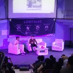


The Faculty of Mathematics and Natural Sciences, Geography Study Program of Universitas Indonesia through collaboration with Esri Indonesia, held a National Seminar on the theme of “The Role of Big Spatial Data in Era 4.0” on Wednesday, November 27th, 2019, at Balai Sidang, UI Campus, Depok.
The seminar, which became one of the series of Geography Days 2019 (G-Days 11th ), was held to welcome the 4.0 industrial revolution or the fourth world industrial revolution, where technology has become the basis in human life and has influenced many aspects of life in various fields including the field of geography.
In the era of the industrial revolution 4.0, the role of Artificial Intelligence (AI) and Big Data Spatial technology is very important as the spearhead of the development of geospatial information technology, including in the sustainable development of Indonesia through the implementation of One Map Policy, disaster management to reduce material and non-material losses, to deal with problems of processing and management of very large spatial data.
From the roles of AI and Spatial Big Data, it can be seen that geospatial information is built for certain decision making in an organization or country. By compiling geospatial information, a policy developed by Geographic Analysis is more accurate and easier to understand. This can be seen in the development of a geoportal system to provide various information about information spatially.
The Dean of FMIPA UI Prof. Dr. rer nat. Abdul Haris said, as an academic institution that has the role of research and community service in the field of science, one of which is geospatial, FMIPA UI feels it is necessary to increase its important role in supporting sustainable national development in line with the development of information technology, including through Geographic Information Systems (GIS) as a place for the development of geography in information technology.
“Management of geographic information to develop the region needs to be supported by the latest technology, human resource development, and community service and conduct scientific research to provide solutions to problems in society”. said, Prof. Haris.
National Seminar officially opened by Prof. Dr. Ir. Muhammad Anis M.Met. as the UI Rector presented speakers with a diverse spectrum of scholarship, namely Dr. Muhammad Dimyati (Director General of Research and Technology Strengthening Ministry of Research and Technology / Indonesian National Research and Innovation Agency), Prof. Dr. Ir Hasanuddin Zainal Abidin, M.Sc. Eng. (Head of Geospatial Information Agency), Drs. Oktorialdi, M.A., Ph.D. (Expert Staff of the PPN Minister for Equity and Territorial Affairs), Bambang Surya Putra, M. Kom. (BNPB Preparedness Director), Dr. Achmad Istamar (CEO of ESRI Indonesia).
The activity that brings together related experts, is expected to be a place of intelligence for the parties involved, by seeing the development of an increasingly age and experiencing changes from time to time in a geographical perspective, as well as obtaining solutions to various problems of utilizing the role of technology Big Data Spatial industrial revolution 4.0.