

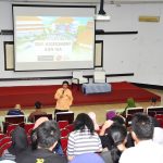
In a panel discussion that was held on Saturday (10/11) in Building C FMIPA UI, Depok. The FMIPA UI Geography volunteer team, which was part of the UI Cares team, presented data after the Central Sulawesi disaster.
The FMIPA UI Geography volunteer team was directly involved in the emergency response phase of disaster management. They are divided into 3 batches which depart at different times.
Batch I, departing 4-10 October 2018, is tasked with mapping the buildings, accessibility and refugee points. Followed by the departure of Batch II on 10-17 October 2018 and Batch III on 22-26 October. Batch II & III have the same task which is to do Building Mapping, Public Facilities, and Social Mapping.
Also read: Post-Disaster Mapping, FMIPA UI Sends Team to Palu and Donggala
Anggoro Tri Muldigono from batch I explained, in providing basic spatial data of the affected area, the Geography Department of FMIPA UI collaborated with various parties such as the Humanitarian OpenStreetMap Team (HOT) through the Mapping Marathon (Mapathon) which succeeded in mapping 5,122 out of a total of 26,663 existing buildings within 3 day and with ESRI Indonesia through a data portal workshop and an operational dashboard workshop as a media for data publication.
In carrying out their duties Anggoro and the team claimed to face several obstacles including disruption of the communication network and electricity that was being repaired by PLN, the condition of the main road in Labean District, Donggala Regency, and the condition of the road in the village of Lende Tovea in Labuana sub-village, Balaesang District – Sirenja District.
“The refugee points that are there are unevenly distributed, some are obstructed by the distribution of logistics because the access road to the refugee points is damaged by landslides so it takes a long time to reach the destination,” said Anggoro.
The first and second groups obtained data related to the number of damaged buildings where Donggala District was the location most affected by the disaster.
Rijali Isnain Haripa in his presentation titled related to the production process of the earthquake and tsunami-affected tsunami map, and Donggala explained from the spatial mapping found that 3396 buildings were heavily damaged, while 1993 buildings were moderately damaged and 596 other buildings were slightly damaged.
The classification of building damage according to him is based on how big the impact of the disaster on the building. The category of damage is when a building is completely razed to the ground.
While moderate damage means that the building has only cracked or partially damaged and slightly damaged where the building has not suffered damage which means only a small crack in the walls and fence of the house.
Based on validated data, continued Rijali, the mapping team on duty at the campus produced maps of suitability areas for temporary housing (Huntara) and multi-disaster affected maps.
The maps, according to him, could help the rehabilitation and reconstruction activities in the disaster area and help the disaster risk-based space planning process.
“Efforts to reduce disaster risk are not merely expenditures but must be taken into account as investments in development”. said Rijali.
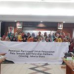
In addition to validating building damage, the FMIPA UI geography volunteer team also conducted other field activities such as coordinating the distribution of aid to disaster victims, providing and installing solar panels, assisting the medical team, building UI Peduli post camps.